Love this app as well. Very handy. Reach, any chance of creating a "Fishbuddy" app? I know it'd be a pile of logistics but a guy can dream!


 HuntingBC Champ
Love this app as well. Very handy. Reach, any chance of creating a "Fishbuddy" app? I know it'd be a pile of logistics but a guy can dream!
 Wolfhound
Reach I just downloaded the app and the maps and cannot access them. I saw your post of deleting the app and reinstalling. Will try it out.
Wolfhound
I'm not as tech savvy as I would like to think so ...so, I look at the maps and when I open and switch from regular to satellite it tells me (not cached). Does that mean they didn't download? I really thought I hit the purchase buttonOriginally Posted by Xenomorph

 Redneck Geek
Sent you a PM. The regular Apple map types (normal, satellite, hybrid) can't be cached but with the mapping package some new types should appear that can be downloaded. The most useful for hunting IMHO is the GeoBC Topo.
 Senior Member
How do I download maps on my samsung from this app so I can use when I have no service
Redneck Geek
I sent you a message but didn't realize you're on Android. The offline maps option is iOS only at the moment. On Android there's no guarantee maps will be available offline; only the boundary lines. You can scroll around in the area you need and the OS does usually cache some maps but the app has no control over how much or how long.
 Banned
Kudu and I where heading into 5-15 (b) for our Moose draw - a long long way from any type of comms.
Here where our concerns / needs
1) How to get help quickly in an emergency (I'm talking airlift if need be)
2) How to keep in touch with others on a regular (daily) basis
3) Our Mu is a skinny one - national parks take up half of the MU and we could easily (unintentionally) wander into the park and find ourselves in deep crap with a dead moose / deer at our feet
We had the hunt buddy app on our phones and IPads we had gps (garmin) and radios - but how to keep it all together in a nice little package?
Kudu downloaded the LEH maps on Hunt budy Zoomed in on 15-2(b) and downloaded topo maps to suit the zone.
He then paired the "Inreach SE" with my his pad / IPhone and we were good to go (Genius)
The IPad / hunt buddy allowed us mobility - it had live tracking 24/7, so we always knew exactly where we where, the SE unit allowed kudu to text his wife's phone and send emails to her iPad 24/7 - and the SOS function would have brought a chopper into our exact location if need be.
This package gets a 100% endorsement from us - (and a couple of others who got the draw and kept coming to us for help on the MU boundaries)
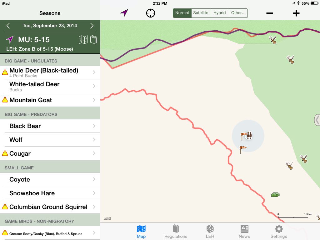
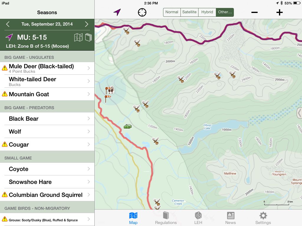
here are a couple of screen shots of the system working - the blue spot is us, unfortunately we forgot to take a screen shot af the Sat (Google Earth) map
standard map (note the national park in green)
Topo map of the same area (note the sightings and moose sign)
 HuntingBC Champ
Dang...wish the android version got that much love.
 HuntingBC Champ
x2 I think he is working on it though
HuntingBC Champ
Oh yes, I mean nothing bad by that comment I still love the app and fully recommend it. I am just jealous of the features on the iphone models, those last screenshots really look appealing.

 Reply With Quote